The short answer
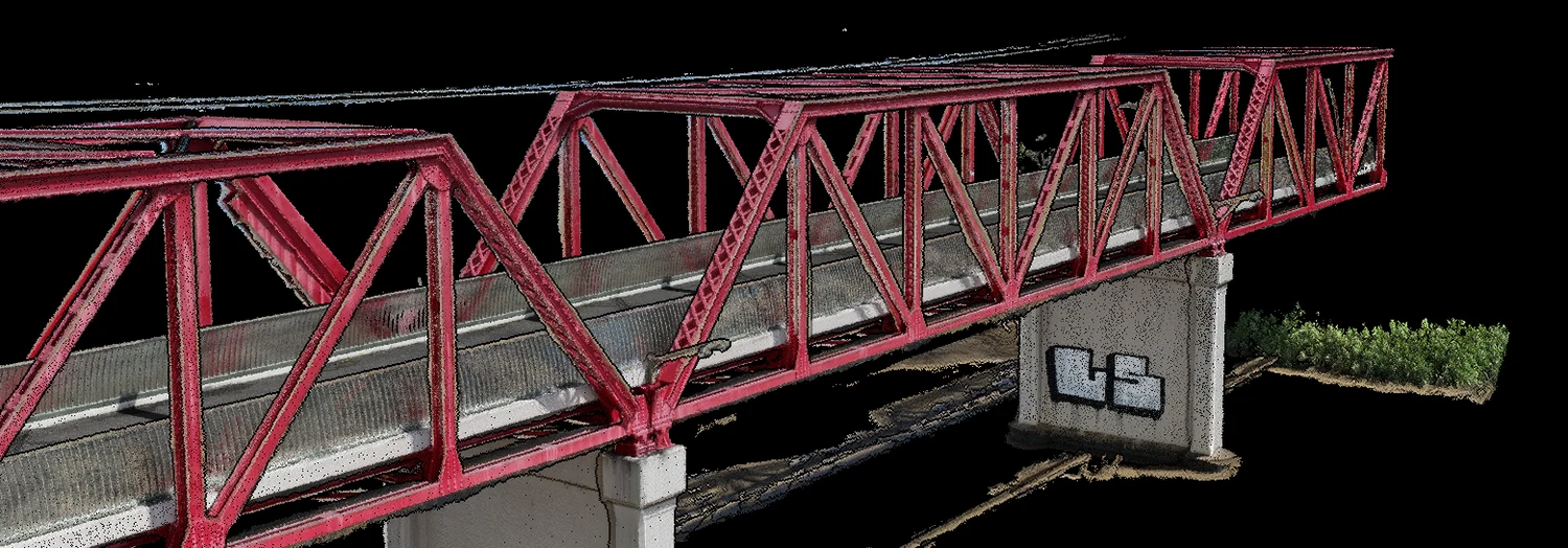
If your project needs a measurable, photorealistic record of a structure (a bridge, a facade, a stockpile, a construction site in open ground), drone photogrammetry delivers everything LiDAR does plus the visual detail LiDAR cannot capture. If your project needs bare-earth terrain under dense canopy, LiDAR is the right tool and photogrammetry is the wrong one. Most civil work in South East Queensland sits firmly in the first category, which is why we built the business on photogrammetry and digital twins and say so plainly.
| Drone photogrammetry | Drone LiDAR | |
|---|---|---|
| How it measures | Overlapping photographs reconstructed into 3D | Direct laser ranging |
| Output | Textured, measurable model — you can see the spalled edge | Geometry-only point cloud (texture needs a camera anyway) |
| Accuracy | Up to 1 cm + 1 ppm horizontal, 1.5 cm + 1 ppm vertical (RTK + ground control); 3–5 mm relative on structures | Comparable ranges; sensor- and IMU-dependent |
| Resolution | Cracks resolved to 0.2 mm width via AI defect detection, at designed capture standoff | Point-spacing driven — typically several mm to a few cm between points depending on altitude and scan settings; coarser than photogrammetry on hard surfaces by design |
| Under vegetation | Models the canopy, not the ground beneath | Penetrates gaps to bare earth — its real advantage |
| Inspection value | High — defects visible in the model | Low on its own — no visual surface |
| Cost & mobilisation | Lighter kit, lower cost | Heavier payloads, higher cost |
| Best for | Structures, inspection, digital twins, open-terrain topo | Bare-earth under canopy, corridor mapping through vegetation |
How each method actually works
Photogrammetry reconstructs geometry from overlapping photographs. An enterprise RTK drone platform flies a designed capture pattern, each image is position-stamped to centimetre level as it is taken, and professional photogrammetry software triangulates millions of matched features into a point cloud, a textured mesh and an orthomosaic. The output is geometry plus appearance: every surface carries its real photographic texture.
LiDAR measures geometry directly. A laser scanner on the aircraft fires pulses and times their return, producing a point cloud from the reflections. Because some pulses slip between leaves, an aerial LiDAR unit can record both canopy and the ground beneath it, which is the property that makes it irreplaceable for certain terrain work. What it records is position and intensity, not appearance: LiDAR points have no photographic texture of their own.
Accuracy: closer than the marketing suggests
On hard, visible surfaces, well-executed versions of both methods land in the same accuracy class. Our RTK photogrammetry workflow delivers up to 1 cm + 1 ppm horizontal and 1.5 cm + 1 ppm vertical accuracy, validated against independent ground control on every job, with 3–5 mm relative accuracy on structures. Survey-grade aerial LiDAR quotes comparable figures.
The practical difference is not the headline number; it's what degrades each method. Photogrammetry accuracy collapses on surfaces it cannot see or match: dense vegetation, water, glass, uniform featureless surfaces. LiDAR accuracy is insulated from texture but sensitive to sensor grade, calibration and trajectory quality, and the cheaper units often fall short of their published figures. Whichever method you commission, the question to ask is the same: how is the accuracy validated, and does the deliverable come with the Survey Quality Report to prove it?
Vegetation: where LiDAR genuinely wins
Photogrammetry cannot reconstruct what the camera cannot see, so under established canopy it returns the top of the trees, not the ground. LiDAR pulses penetrate gaps in foliage, and with proper classification the ground returns can be separated out into a bare-earth terrain model.
For greenfield corridors through bushland, forestry terrain, or flood modelling under vegetation, LiDAR is the correct specification, and a photogrammetry operator who claims otherwise is selling, not advising. For cleared construction sites, quarries, stockyards, structures and built assets — the overwhelming majority of civil work — the canopy problem simply does not arise.
Deliverables: textured reality versus pure geometry
A photogrammetric deliverable is inspectable. The textured mesh shows the crack, the corrosion stain, the spalled edge, the as-built detail, which is why visual inspection programs, dilapidation records and AI defect detection run on photographic capture. The orthomosaic doubles as a current-conditions base map under design drawings, and stockpile measurement comes from the same flight; our volumetric reporting is photogrammetry end to end.
A LiDAR deliverable is geometrically rich but visually mute: superb for terrain surfaces, canopy analysis and clearance modelling, less useful the moment someone asks what the surface actually looks like. Many projects that commission LiDAR still need a photographic layer on top — at which point the question becomes whether one photogrammetric capture would have served both needs.
Cost and processing time
Photogrammetry carries lighter hardware and lower mobilisation cost; its processing is compute-heavy, so turnaround scales with site area and resolution. LiDAR carries a substantially more expensive sensor and tighter calibration workflow, reflected in day rates, while its point cloud arrives with less processing between capture and delivery.
For the single-structure and single-site work that dominates civil programs, photogrammetry is generally the more economical path to a survey-grade result. For repeated wide-area terrain mapping under vegetation, LiDAR earns its premium.
When to use each
Choose photogrammetry when the deliverable is a digital twin, a visual inspection record, a defect register, an orthomosaic, stockpile volumes, or any output a human will look at as well as measure. Choose LiDAR when the deliverable is bare-earth terrain under canopy, corridor mapping through vegetation, or dense geometry where appearance is irrelevant. Some modern software supports fusing both data types, and on projects that genuinely need both properties, fusion is a legitimate specification rather than a compromise.
We operate photogrammetry, not LiDAR, because it's the right tool for the structural and site work we specialise in.
Common questions
Q/01Which is more accurate: photogrammetry or LiDAR?
Neither wins outright. With RTK and measured ground control, photogrammetry reaches up to 1 cm + 1 ppm horizontal accuracy and 3–5 mm relative on structures, validated with a Survey Quality Report. LiDAR's edge is not headline accuracy; it's measuring ground beneath vegetation.
Q/02What's the resolution difference between photogrammetry and LiDAR?
Photogrammetry's fine-detail capability comes from image resolution at the designed capture standoff; our AI defect detection resolves cracking to 0.2 mm width on hard surfaces. LiDAR's resolution is a function of point spacing, typically several millimetres to a few centimetres apart depending on altitude and scan settings — coarser than photogrammetry on hard surfaces, though that's not what LiDAR is for: its advantage is penetrating vegetation to the ground beneath, not resolving fine surface detail.
Q/03Which costs less?
Photogrammetry, in general, thanks to lighter hardware and lower mobilisation cost. LiDAR's sensors and processing typically carry a real premium, though the exact gap depends on the platforms being compared.
Q/04Can photogrammetry replace LiDAR under dense canopy?
No. Photogrammetry models what the camera sees: the top of vegetation, not the ground beneath it. Bare-earth terrain under canopy is the clearest case where we'd point you to a LiDAR operator at quoting.
Q/05Which is better for structural inspection?
Photogrammetry: an inspectable model needs surface texture. A geometry-only point cloud can't show cracking, spalling or corrosion.